Library Record
Images
Additional Images [19]
Metadata
Object ID |
1997-216-1270 |
Collection |
San Jose Master Catalog |
Object Name |
Atlas |
Author |
Brainard, Henry A. |
Title |
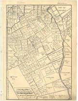
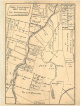
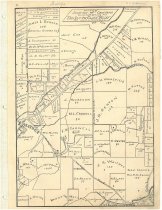
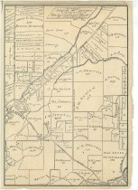
1880 Santa Clara County, Brainard Agricultural Atlas. |
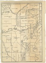
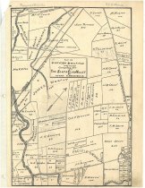
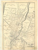
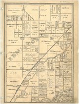
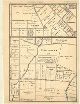
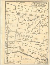
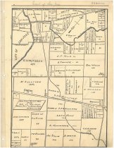
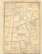
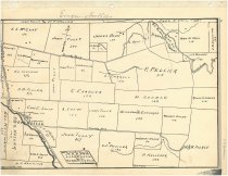
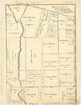
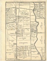
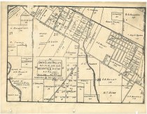
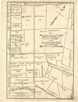
Summary |
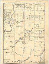
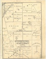
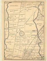
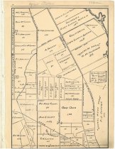
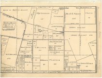
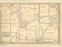
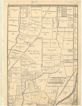
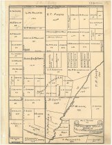
Atlas of the major agricultural regions of Santa Clara County in the 1880s. This atlas does not cover urban areas, nor agricultural areas in the southern part of the county. Each regional map shows property lines, number of acres, and the name of the property owner. Some of the regional maps have supplemental information, describing the area in general and giving the kinds of crops grown on each property. The maps and supplemental information were originally published in issues of Pacific Tree and Vine Magazine. [map no. 1]. Hamilton District -- [map no. 2]. "The Willows" -- [map no. 3]. Part of Berryessa & Milpitas Districts -- [map no. 4]. Los Gatos and vicinity -- [map no. 5]. Vicinity of Saratoga, California -- map no. 6. Cupertino district, July 1885 -- map no. 7. Union District, August 1885 -- map no. 8. Orchard District, October 1885-- map no. 9. Jefferson School District, November 1885-- map no. 10. Vicinity of Lawrence Station, December 1885 -- map no. 11. District west of Santa Clara, January 1886 -- map no. 12. Quito District, February 1886-- map no. 13. Collins and Cupertino District, March 1886 -- map no. 14. Part 1 South of Santa Clara -- map no. 14. Part 2 Lincoln District, April 1886 -- map no. 15. Eastern Berryessa, May 1886 -- map no. 16. East of San Jose, Berryessa, Pala and Jackson Districts, January 1886-- map no. 17. Pala Rancho and foothills, July 1886 -- map no. 18. Evergreen and the Yerba Buena Hills, August 1886 -- map no. 19. Collins & Mountain View, September 1886-- map no. 20. Franklin District, October 1886 -- map no. 21. The Almaden Road, November 1886 -- map no. 22. Mountain View, April 1887 -- map no. 23. A part of Jackson, Silver Creek and Evergreen Districts, East of San Jose, June 1887 |
Subjects |
Maps Agriculture (LCSH) Santa Clara County (Calif.) (LCSH) Nineteenth century (LCSH) |
Physical Description |
22 maps ; 33.5 x 25 cm, in cover 34 cm |
Year Range from |
1885 |
Year Range to |
1887 |
High resolution image |
View online (San Jose Public Library) |